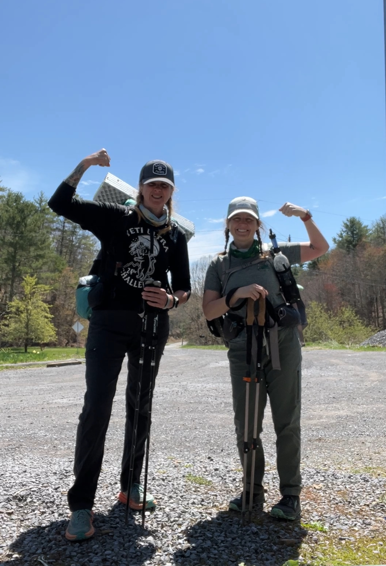
I guess you could say that we slept in on Saturday morning. It was fully daylight before we made any moves to get up and ready for the day. But, if you know Misty, once we are getting ready to go, the race is ON.
We knew it was going to be a chilly morning-in fact, the coldest day of the trip overall, and we had saved warm, dry clothes for today. After packing away most of our gear, we made our way to the pavilion to make our morning meals and get our food planned out for the day.
Today's mileage was really up in the air. Because we had hiked more miles than planned every day so far, we were way ahead of schedule. Our choices for camping tonight were not abundant, and really, we had two choices: either camp around mile 12.5 or make it to a shelter at about 21.5 miles. I guess we'd see how the day played out!
Our days usually seem to begin with a hefty uphill climb and today was no different. I don't think either of us minded too much, though, because it was a cold start! We made quick work of getting up and over the first climb, and then it was down, down, down.
We were on the hunt for water again, too. Really, there is a lot of water to be had on the trail in Virginia, but we didn't want to have to carry more than necessary-water is heavy! Soon, we crossed a little bridge and found a water source below.
While the blowdowns and re-routes from Hurricane Helene were less in this area than in the southernmost part of Virginia, we did our share of following detours around severely damaged areas, as well as going up and over many, many trees.
By 11am we had reached Lick Creek. The large bridge that used to cross Lick Creek had been washed away in 2020, and we knew the only way across it now was through it. We had anxiously been watching comments from other hikers on FarOut regarding water depth here, and it seemed that we'd be able to get across without much trouble. This was by far our biggest water crossing to date, but we were ready for it. We stopped to take off our shoes and socks and then, due to the rocky river bottom, decided to wear our camp sandals to cross. The weather wasn't doing us any favors, hovering at right around thirty degrees.
I was the first to cross. The current was gentle here, but a little more than halfway across, the water finally got to me, and it was so cold. Not February-river-crossing cold, but still pretty dang cold.
And then it was Misty's turn. Her reaction was pretty similar to mine! She made it across safely and then we found places to sit and dry off and put our shoes and socks back on.
We decided to have a small snack here as well, and that's when Misty realized something. And it wasn't good. Her water bottle with her filter had fallen out of her pack on the other side before we had crossed! She had to have that! So, off came her shoes and socks once again, and she went across, found her bottle, and then came back again. That was some unplanned extra coldness for her!
Now don't go thinking that the water froze us and we couldn't warm up. Oh no, that was not the case, because, of course, we had another uphill climb in front of us! This one started slowly, and then steps were needed, but it turned out to be a little magical, as well!
And then things got a little crazy. Ahead of us was our biggest climb of the trip, and it was a doozie. In the next five miles, we were going to be hiking up about 2,400 feet. Here we go!
This climb was different from other climbing we had done because of the terrain, too. We weren't on a little single-track trail. This was a wide, grassy trail, with lots of wide-open spaces.
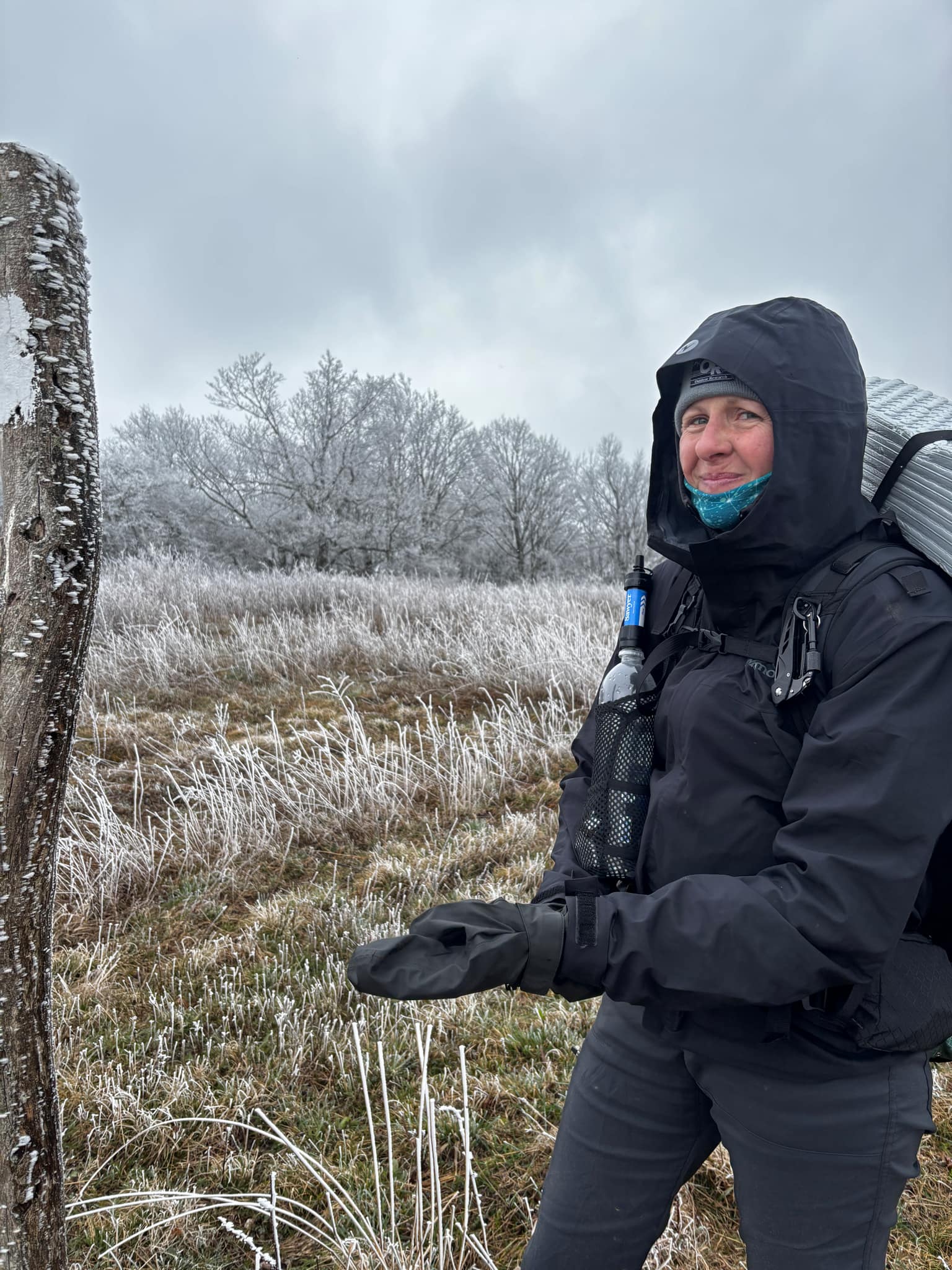
As we hiked up, the temperature went down. The new spring buds were now frosty. The spiderwebs were, too!
The trees went from brown and green to white. We gradually zipped up our coats and pulled on our hoods. It was getting colder and colder, even though the uphill climb should've been overheating us. I wasn't really that enthused about the weather up here!
The landscape just kept getting whiter and whiter, without there being any snow! It felt like we were in another world, and there was no one else to be seen anywhere!
Finally, we reached the summit. Have I mentioned that it was cold? I'd say it was safely about zero degrees with the windchill. Atop Chestnut Knob, elevation 4407ft, was Chestnut Knob Shelter. The shelter is actually the old fire warden's cabin and has been converted into an enclosed trail shelter. Inside there are 8 bunks for hikers and no wind can get in! (I bet the mice still can, though!)
Although, it was so cold up here, the view was quite amazing. When we are up at high elevations like this, Misty and I always comment about how it's probably 80 degrees and sunny down in the valleys below. It's strange to think how different the day could be from where we stand high above.
We had to get a move on, though, because it was after 2pm, we had only hiked about 12 miles, and we definitely didn't want to spend the night in this shelter! It was beautiful up here with the frosty finish on everything.
It was time to bound down the mountain and get to warmer weather. As we went down, the frost slooooowly faded away...
After hiking another hour, we made it to lower ground and the frost was gone. We took off our packs for a much-needed break and followed a blue blaze trail to a water source. There had been no opportunity for water refilling up there in the arctic!
The next five miles were very difficult. After the trail had dipped down, allowing us a water stop, it climbed back up once again. We did not care for this one bit! How could the trail be going back up again already? We weren't ready!
With some very short descents, and some rocky, steep inclines mixed in, the trail hovered at right around 4,000 feet. The grayness of the day had worn off, and around 4pm, THE SUN CAME OUT.
With the sun came warmth, and when the warmth came, those frosty, white treetops way overhead started letting go! Small slivers and chunks of ice were falling all around us. Sometimes they would hit us in the face, which I was not a fan of. When the wind would die down and the sun would go behind a cloud, the ice barrage would stop, and then when the sun and wind returned, so did the falling ice. It was crazy! Can I just hide in the rhododendrons, please?
The trail continued to be quite challenging, and every time we'd have a slight downhill, it seemed like an even bigger uphill was in front of us. After the long day yesterday and the extra-long climb today, my legs were definitely stressed.
We did pass the famous "boob on a blaze" tree, which was very cool. (We made that up, but I do love a good burl.)
For the last hour or so, we had casually been looking for an acceptable place to camp for the night. Usually, we can find a site not listed on the app that is suitable for our tents, but that was not the case tonight. There was absolutely no flat ground.
We did, however, find a pair of glasses. And you know what they say, if you find them you must wear them. Actually, I think only my friends say that and I think it only applies to me, but whatever. I put on the glasses.
Things then took a serious turn. It was 6:45pm, and we had a GOOD three miles to get to the next shelter where we knew there would be campsites. With more than 18 miles already on our legs, I had no idea how we would get there in daylight. The trail was so rough and rocky and filled with obstacles that we couldn't have kept a good pace even if we had fresh legs. Anxiety!

It was a pretty steep downhill hike to get to the shelter, and we were going as fast as we could. There was very little talking between Misty and me. The internal monologue in my head was ridiculous. "I can't go any faster. Yes I can. I think I can run. I'm running. Running hurts. I'm going to regret running tomorrow. We can make it by 8. We can't make it by 8. We have headlamps. It's FINE. It's fine. We can just go slower if it gets dark. We'll get there. My feet feel like hamburger. I should run some more. I'm running again. Still not a good idea. I can walk fast. Ok, I can walk but not fast. Oh great, Misty is stopping to wait for me. I am so slow. We can't make it in daylight. We need to get there in daylight. We don't need to make it in daylight! If we don't make it we have headlamps. It's FINE! OMG why are there so many trees down? Do I go over or under? Misty went under. I can't go under. I'll go over. Oh man, over was a bad idea. That's going to leave a bruise. My feet hurt SO badly. I think I can run again! Running is such a bad idea. I can't believe how slow I am. Misty is looking at me again. I am ruining our pace! We have to make it in daylight! We don't need to make it in daylight. We have headlamps. We can go slow in the dark. It's got to be getting close. It's fine! EVERYTHING IS FINE!"
I am not kidding you when I say that my brain literally did that for nearly four miles. I kept looking at the remnants of the daylight up over the treetops, wondering if there would be enough left to guide us to the shelter area.
And then the trail changed a bit. It's hard to explain it, but on the AT, when you're nearing a shelter, the trail seems a little different than before. It starts to look like this:
And I knew we were close-so close. We were going to make it. Just a little further and we'd be there. Where was the shelter? And then, by some miracle, just before 8pm, we saw this sign and my whole body relaxed.
We turned left and immediately there were people! Lots of other hikers were there, both in tents and in the shelter! And there were so many campsites to choose from! It was absolutely glorious. Within less than ten minutes, and with a little daylight to spare, our tents were up!
Words cannot express how relieved I was to crawl into my tent, safe and sound. Words can also not express how incredibly exhausted I was. While Misty was starving and hurrying to cook a meal, there was no energy left for me to cook anything. I was too tired to eat, anyway. I managed to eat a single packet of tuna, and four crackers before I cinched up my sleeping bag and passed out. The day was finally done.
Total miles: 22.23
Elevation gain: 6,227 feet
Calories burned: 5,952