Sunday, February 23, 2025

Day Three: Lost Mountain Shelter to Railroad Market & Cafe Northbound on the Appalachian Trail

The rain completely stopped for the night as we snuggled into our sleeping bags, and I promptly passed out.  At 10:50pm I awoke with a start as a strong gust of wind whipped through camp.  I felt pretty sure of my tent stakes and had already checked for any "widow-maker" trees in the vicinity, so I drifted back to sleep.  The wind, however, was persistent and fairly relentless.  Off and on all night, huge waves of wind rolled overhead, thundering through the treetops.  I thought to myself, "Hey, at least my tent will be dry when I pack up in the morning!"

And then, just before dawn, the rain started again.  So much for a dry tent!  Another hiker had come into camp a little after 9pm the night before, but after assessing the chaos in the shelter, he opted to set up his tent in the trees near us.  He hadn't stayed for long, though, and left northbound on his thru hike at first light.  Happy trails, Slide!

Quickly, the rain went from rain to RAIN.  Misty, Chelsea, and I were yelling at each other over the noise of the rain from our tents, discussing the day's plan.  They had heard from Bunny overnight, and our one mile hike out had to be extended due to a road closure somewhere between where we were and where she was coming from.  Our new instructions were to hike one mile on the AT and then turn right when we reached the road and hike four road miles to our designated pick up point.  Honestly, with all the rain and mud and rough terrain, four miles of pavement didn't sound that bad!

After thoroughly re-soaking all of our gear, the rain decided to slow to a slight drizzle once again, and we began to pack up.  This turned out to be quite the task for Amy and Kara with all of their overly wet gear.  Thankfully, the morning wasn't too chilly, and we all had full use of our fingers and toes!


The one mile hike out was short but pretty, once again among the rhododendrons.  Down, down we hiked toward the road below, and soon we were crossing a cute little bridge and came out to US 58.  


We turned right and began our road hiking.  All of us were in good spirits, knowing that in just a few miles we'd be meeting up with Bunny for a ride to the hostel.  


After a bit, the road led us out of the deep forest, and we began to see signs of life!  An occasional car would zoom by, a mailbox here and there indicated that yes, people did actually live out here, and there were tree farms everywhere.  


After about two miles of road hiking, we started to wonder if we were going in the right direction.  If the road was closed, why were there cars passing us in both directions?  Were we actually on US 58?  The road signs we passed were calling this road "Jeb Stuart Highway."  What if we had hiked two miles in the wrong direction?  Of course, there was absolutely no cell service to check a map or get ahold of Bunny.  

We reached a crossroads, where our road bent to the left, another road came in from the right, and a little white church was nestled in between.  There was a lone car sitting in the tiny church parking lot, so Kara decided to go inside to see if she could get some assistance in finding out our location.  

After what seemed like a long time, Kara returned and informed us that Damascus was the other way on US 58.  Great.  Chelsea and Misty sent another satellite message to Bunny to verify our route.  We were informed that you could get to Damascus either way on US 58 and that we were, in fact, headed in the right direction.  This made no sense to me, but I guess we were just going to go with it.  Bunny also informed us that she was very delayed due to a car vs. cow accident on the road.  Ahhh, country life.  We didn't know how delayed she was, or even where she was, but we continued our hike.  

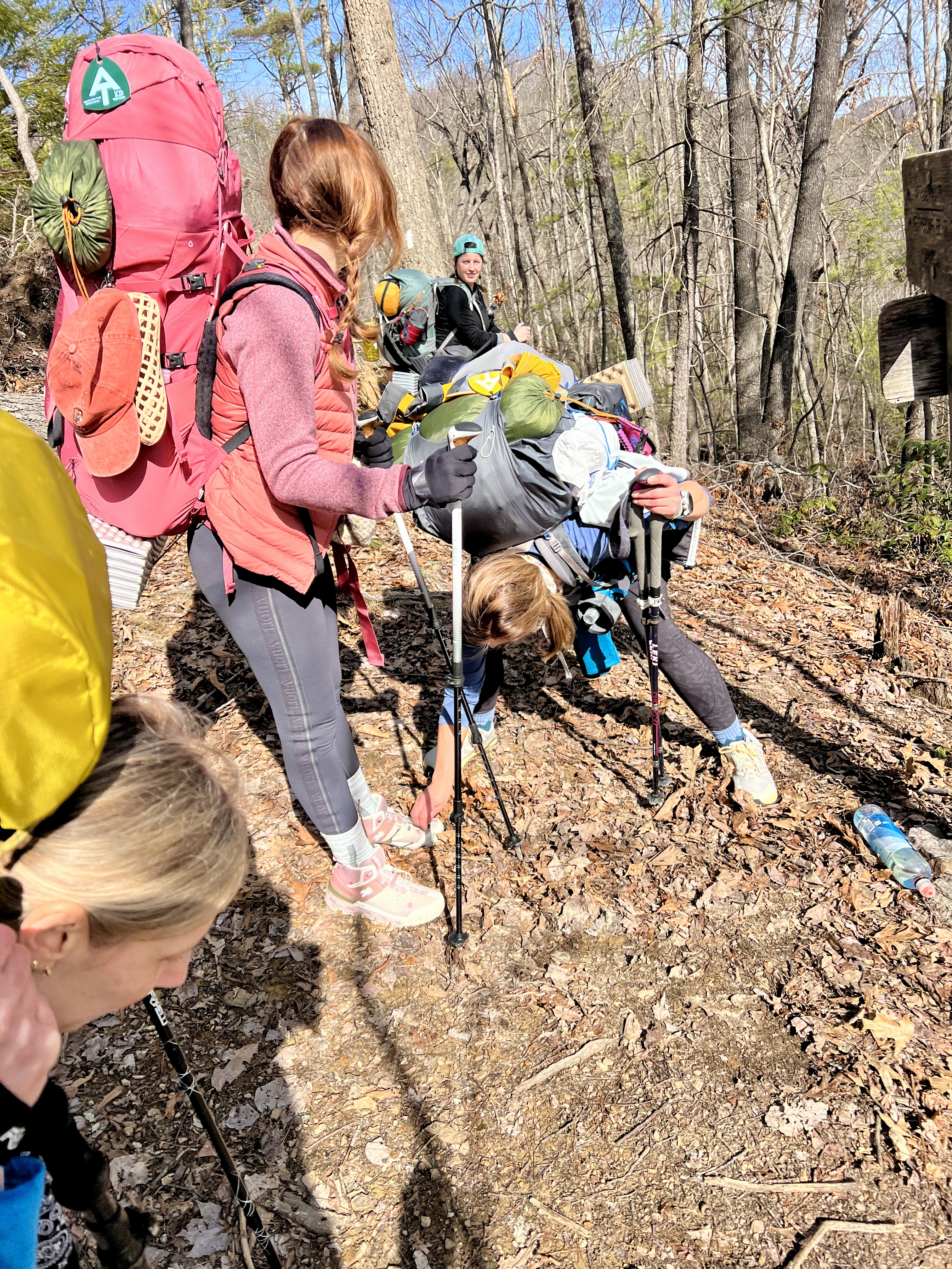
We were nearing the end of our four miles on the road, when three large dogs ran out from a nearby house.  I have to say that I've had many more scary encounters with dogs than I have had with people on trails, and having barking dogs rushing towards you is not the best feeling.  The owner appeared in the doorway of the house and called them back.  They turned and ran away from us.  As we approached the driveway, the man came out to meet us.  He asked if we were hiking the AT and what our plans were.  We informed him that we were hiking to our pickup spot and would be getting off trail overnight to dry out.  He wished us well and we were on our way again.

But then, he called out to us again and asked if we'd like some help.  I said yes before I even knew what he was offering.  We headed back to his house where he offered to drive us to where Bunny would pick us up.  That sounded great to me, especially since we weren't exactly sure where to even find Bunny.  Two of the girls went inside to use the phone there to get ahold of Bunny, while the rest of us waited outside and played with the three super friendly dogs in the yard. 


It was decided that we'd meet Bunny at a new gas station/cafe a few miles down the road.  Mark, the owner of the house, generously offered to drive us there.  His wife said another round of rain was on its way and we had no desire to get drenched yet again.  So, the five of us threw our packs into the back of his truck and piled into the cab. It turns out that although Mark had been living in the south for many years, he was actually from Grand Rapids, Michigan.  Small world!  He was also a U.S. Marine, which you know holds a special place in my heart.  We were so thankful for his kindness in our little struggle to get off trail.  I spotted this stone in his yard while we were waiting, and I think it was quite accurate.


We pulled into the Railroad Market and Cafe, and I was pleasantly surprised to see a row of benches neatly tucked under a large overhang at the front of the store. While we waited, we sipped on coffee and hot chocolate, and then, the world's worst storm came through.  First there was rain.  Then there was wind.  Then the mountaintops disappeared into the fog that had settled everywhere.  Then the rain turned into sideways rain.  I had never been so happy to be camped out at a gas station in my entire life.  If Mark had not given us that ride, we'd be out there hiking in that!  


We waited for nearly an hour for Bunny.  She had had quite an ordeal getting to us that morning and we were so happy to finally see here again!


It was after 1pm when we finally arrived in Marion, VA.  Bunny dropped us off at Marion Outdoors, a gear shop we had become familiar with via TikTok.  The star of those TikToks was Coach, the owner of Marion Outdoors, and he was there at the desk to greet us.  We wanted to check out the store, but we really wanted to get clean and dry first, so we paid our fees and checked into The Merry Inn Hiker Hostel, also owned by Coach, and just upstairs from the store.


We climbed the stairs of The Merry Inn, and almost immediately exploded our gear everywhere.  Every available surface had tents and tarps and sleeping bags and sleeping pads and coats and packs draped over them.  We threw everything we had been wearing into the washing machine, took long, glorious, hot showers, donned donated hiker clothes, and put our soaked shoes on the boot dryer.  It is safe to say that we completely took over the whole place.


Once we were clean and dry and settled, we headed downstairs to check out the shop.  Amy and Kara needed new rain pants, Amy needed a new sleeping pad as her had sprung a leak, and we all wanted little mementos of this cute little place.


The next order of business was food.  We were now desperately hungry.  Our small breakfast way back at the shelter on trail and the gas station snacks a few hours ago had long since worn off and we were starving.  The nearest and most recommended restaurant was right next door.  We headed to Macado’s for an early dinner. The food was so good, and we ate way too much but we all decided to take gigantic cinnamon rolls back to the hostel for later. 



By the time we returned from dinner, our gear and clothing were dry, and we began to pack our bags once again.  It was Sunday evening, and we'd be returning to this hostel on Wednesday, so we decided to leave some extra food and gear behind we wouldn't need in the next few days.  Anything to make our packs a little lighter was definitely welcomed. 


Sunday night was a good night to be off trail, since temperatures would be dipping down to the single digits.  I think we made a smart choice with the hostel stay, especially with all of the wet gear we had. 


We played a few games in the lounge as we discussed our plans for the next few days.  Should we go back to where we left the trail and hike north from there?  Should we skip ahead a little and start at Grayson Highlands and go north from there?  What about Mount Rogers?  I really wanted to see Mount Rogers.  Should we start in Marion and head south, finishing where we left off today?  The weather was a factor.  Predictions of high winds and very low windchills were predicted on Monday and into Monday night.  Around and around we went, throwing out different options, never settling on one.  Finally, after two hours of discussion, and with the weather as our guide, we made a plan.  We'd have our shuttle driver drop us off just a few miles south of Marion in the morning, hike ten miles, and stay at Old Orchard Shelter, elevation 4076 feet.  This would be much warmer than camping at higher elevations near Grayson Highlands and Mount Rogers.  Then, on Tuesday, we'd hike from Old Orchard Shelter to Grayson Highlands and either get picked up there on Tuesday evening, or camp just south of the park and arrange a pickup on Wednesday.  Our other concern was that we were watching a potential winter storm which would be arriving sometime on Wednesday.  With no cell service, we'd have to use satellite service to get a weather report on Tuesday.  Several inches of snow could be very dangerous with the current trail conditions. 


Is your head spinning yet?  Because mine sure was.  I have never had to change plans so much on a trip as I had already done in the first three days of this trip.  This weather was giving us a run for our money. Can we just get back to the trail already?!


Total miles: 3.95 (1 on the AT)

Total elevation: 640 feet


Saturday, February 22, 2025

Day Two: 476.9 Campsite to Lost Mountain Shelter Northbound on the Appalachian Trail

The river thundered below us all night long, drowning out any other sounds in the forest. We woke before dawn, tired of being in our sleeping bags for nearly 12 hours. It wasn't overly cold, but we made our coffees from the openings of our tents, trying to hold onto as much warmth and dryness as possible. And then the rain began. Unfortunately, this meant we had to pack our tents wet. Rain or no rain, the show would go on.


The rhododendron-lined trail followed the river, and we could see the devastated Virginia Creeper Trail on the other side. Every bridge was washed away, and huge sections of trail were missing, too. What a sad sight to see.  Because of the rain, every trickling stream was much larger, giving us many opportunities to get our feet wet if we weren’t careful.  


Soon the trail began to climb, and it was steep. So steep!  We had to stop and remove layers because our rain gear was trapping in so much heat.  And then the rain went from light rain to RAIN. I checked my watch and couldn’t believe that we hadn’t even gone two miles! This was going to be a long day. 


We decided to head to Saunders Shelter for a pack break and to have a snack out of the rain. 


At this point, we finally all had our trail names.  Chelsea was now Rosy, due to her pink pack and endless pink gear. Kara was named Animal during our last AT trip and the name has stuck.  Why Animal?  Well, let's just say she has her own unique way of packing and carrying her gear and she reminds us of Animal from The Muppets.  Amy was named Free Bird, because she came to this adventure without a watch or any other form of GPS tracking-unheard of!  Misty was named Seal because she wore big, black rain-proof glove covers which made her look like she had seal flippers.  And me?  I was named Pioneer Woman early last year after I showed up to a running/hiking weekend with fresh eggs and homemade truffles for everyone.


It was nice to sit for a bit, and to have a little relief from the rain and difficult terrain, but it was time to get back on trail.


I think we sat there a little too long because by the time we left I was very cold. I said, “Let’s hike out of here fast to warm up!” And I took off. When I turned around, no one was behind me. I figured someone needed a last-minute pack adjustment and they’d be along shortly. But then they weren’t. I called to them but got no reply. Where were they?  I kept yelling for them and thought I heard a reply once, but it was coming from somewhere beyond the shelter. Did they get ahead of me? Did they go another way? Should I go down the trail and try to find them? I yelled one more time and finally heard them. They had followed a blue blaze, but the one that led to the water source, not the one that led back to the AT. Once reunited, we took the correct blue blaze trail back to the AT and headed north. 


My hands were so cold inside my soaking wet gloves. I kept balling my hands up trying to get warm, but eventually, I ended up taking off the gloves and pulling my bare hands up inside my shirt sleeves. The steep climb we were hiking combined with a break in the rain allowed my hands to warm up enough to hold my trekking poles again. From seemingly nowhere, Kara pulled a bag of Valentine's conversation heart candies from her pack and shared them.  Instant mood lifter!


What goes up must come down and soon we were down along the raging river again with the VCT on the opposite bank.  There were so many little stream crossings and we were thankful for every little bridge we came to.


The big river was so loud and very fast moving, and all of the rain we were getting was certainly not helping anything.  I had a bad feeling that we were going to come to a stream that we couldn’t cross due to all the flooding, but there ahead of us was a glorious well-built bridge high above the deafening water below. 


We had been diverted off the trail on several re-routes due to downed trees and landslides caused by Helene. It was strange how the forest could look totally normal one moment and then we’d turn a corner and there would be chaos. This terrain combined with the rain caused the miles to pass very slowly.  Again, we were so very thankful for all of the trail clearing that had been done.  Even getting the proper equipment into those remote areas to cut and move the massive trees must've been a challenge.


After several hours of hiking in the rain and mud, slipping and sliding through the forest, we were ready to call it a day.  The Lost Mountain Shelter sign came into view right when we needed it.


Amy and Kara had a bit of an issue with their rain pants not actually being resistant to rain, and they were thoroughly soaked.  Because of this, they decided to set up a tent to share inside the shelter to get fully out of the relentless rain.


Meanwhile, Chelsea, Misty and I set up our tents among the trees behind the shelter, making sure that we were safe from any potential blowdowns overnight.  When I tell you it was wet, it was wet. Anything not in our waterproof liners (I used a trash compactor bag) was wet.  Our shoes were wet.  Our packs were wet.  Our tents were wet.  One bonus of having a two-person tent is that there is a little room to spread out on nights like this.  I designated one corner as the "wet corner" and laid out everything that needed to dry on a chamois towel.  I had little hopes that my sopping wet gloves and shoes would dry, but there was nothing to be done about that. 


 Upon setting up camp, Kara discovered that her sleeping bag was also wet.  This was not good.  She had gotten chilled during the last part of our hike and now she was having a hard time getting warm with all of her wet gear.  While she layered up on clothing and tried to get warm in the tent, Amy hung clothing and gear everywhere she could inside the shelter.


There would certainly be no campfire tonight, as the forest was thoroughly saturated, and we all made our dinners from the openings of our tents.  Thankfully, inside my tent, I was warm and dry and outside, the rain was starting to die down.  


Thinking about what the next day would hold, I knew that much colder temperatures were on the way.  I was quite concerned that we did not have enough dry gear to get through another night safely.  I discussed this with Chelsea and Misty, and we decided we should try to get off trail in the morning.  Thankfully, the newest iPhones have satellite messaging capabilities even when there is no cell service.  The girls were able to get a message out to the hostel and somewhat arrange a ride out in the morning.  We'd just have to hike one more mile in the morning, and then we'd be picked up and taken to the hostel to dy out, warm up, and regroup.  I headed over to the shelter to give Kara and Amy the news that we'd be evacuating in the morning, and there were literal tears of joy.  I think that having a plan in place was a huge morale boost and helped everyone get through the night.


But...there's always a but, isn't there?  You know what they say about the best laid plans...  We had no idea what Sunday had in store for us.  Stay tuned for Day Three!


Total miles: 9.66

Total elevation gain: 3038 feet


Friday, February 21, 2025

Day 1: Damascus to Campsite 476.9 Northbound on the Appalachian Trail

Friday, February 14, 2025


 Last Wednesday, we were all filled with nervous anticipation as we waited for that early Friday morning departure for our next Appalachian Trail adventure.  And then, someone suggested we leave Thursday instead.  Why not?  We were packed and ready and could leave in the afternoon, so we changed our plans.  

Amy drove down from the Great White North, we left from my home and picked up Kara as we headed south, and then Chelsea and Misty a little further south.  The Beast, as we lovingly named my gigantic van, was overflowing with gear and road snacks and last-minute additions to our packs.  We decided we'd travel until I was tired and then get a hotel before finishing the trip in the morning. Along the way, we added a few new stickers to The Beast.

We made it all the way to Charleston, WV and then Kara found us a nice hotel suite that would hold all five of us.  It was a short night of sleep, and we were up early to make it to our 10am pick up in Bland, VA.

As soon as we pulled into our little parking area where I'd be leaving The Beast for the week, a maroon truck covered in stickers pulled in.  This must be Bunny.

Bunny was a little livewire, and I think she was as excited to be shuttling us as we were to have her as our driver!  We quickly threw our massive packs into the bed of her truck and piled inside-one in the front, four in the back.  It was a tight squeeze!


As Bunny pulled forward out of the lot, she hit a caution/parking sign. She paused only briefly before continuing over the sign and said, “Well, I’m taking that down," and "We’ve got better things to do,” and “This isn’t the first time."  This made me a little nervous to be sitting four people across in the backseat of her truck with no seatbelts. What were we in for on this ride? 


It turns out that Bunny is a really awesome human and she is also the caretaker at the Merry Inn Hostel, which is where we planned to stay on Wednesday night. She told us stories of her three consecutive thru hikes in 2000, 2001, and 2002, as well as throwing in some tips for our own hike.


Once in Damascus, she took us to the Damascus Trail Center and told us if we needed anything between now and Wednesday to give her a call and she could meet us at any trailhead.  It seemed we'd have someone looking out for us while we were out there, which was comforting to say the least.  After some parting pictures, she left us there.


We made our way inside the center and were greeted by Drew.  Drew was another amazing human. She was so full of information and took all the time that was needed to give us info about the trail and trail conditions, and the fact that we would not have cell service most likely until we got to Marion on Wednesday.  We took a moment to notify our families back home that basically "no news is good news" and we'd contact them when were able.  Luckily, the 2025 AT hang tags had become available just that day, and we were given the first five tags for hikers heading out of Damascus-pretty cool!


Drew showed us the trail ahead on a topographical map, where she pointed out shelters, alternate routes, Mount Rogers, Fatman Squeeze, and other highlights we'd encounter over the next few days.  One last photo and we'd be ready!


Finally, it was time to go.  The center was actually ON the AT, so all we had to do was cross the street and take the sidewalk out of town.  Drew had given us a recommendation for Wilson’s Cafe for lunch. We decided to make our way there, taking in the sights of downtown Damascus as we walked.


Wilson’s was pretty much the last stop as we were heading out of Damascus, and we decided to have one last hot meal. It was a good one. Our waitress was awesome, the food was delicious, and we left full and happy and ready for the trail ahead.


The Appalachian Trail shares the Virginia Creeper Trail as it heads north out of Damascus. We were told the VCT had substantial damage from hurricane Helene, and it was recommended that we take the AT even though it was a steeper hike up and out of the city. Everywhere we looked we could see remnants of the damage that Helene had left in her wake. Bridges were out, houses were flooded, debris was everywhere. It was very clear that the towns affected by this hurricane will take years and years to recover fully from the damage.


After crossing the main road, the AT heads up into the mountains via a staircase. This was it!  Our adventure was fully underway!


 It was so good to be hiking among the Rhododendron again. That green tunnel gets me every time!


With the steep uphill climb, we warmed up very quickly and soon stopped to shed layers. The sun was shining, and the sky was blue, and it was perfect weather for a first day on trail. I also noticed rather quickly that all of the water sources that had dried up or had just been a trickle in the fall were now heavily flowing. As we climbed, we hopped over the occasional little stream.  We continued climbing, and as we got deeper into the forest, there were many more blow downs from Helene. We spent a lot of time rerouting around gigantic trees that had uprooted and destroyed the trail. There had been so much trail maintenance over the last few months and overall, we couldn’t have been happier with the condition of the trail under the circumstances. 


We decided to hike past where we had originally planned to camp for the night, having left Damascus earlier than planned. 


We were thinking of making it to the first shelter northbound (NOBO), but soon realized that the amount of time it was taking to get around all of the trail damage was going to make that not possible. We chose a campsite about two miles further than what we had originally planned for the day and headed for that. 


What we didn’t know was that just up ahead, we would come to a much deeper and wider-than-anticipated stream.  After taking some time to search for a better way to cross than where the trail took us, or possibly some large rocks or a log we could use, we realized that the only way across the stream was through the stream.  I really had no desire to walk across an icy cold stream on Day One of this hike, but I guess we were going to go for it.  So, we rolled up our pants to above our knees and took off our shoes and socks. One at a time, we walked across through the icy water.  First went Kara, then Misty, then Chelsea.  Amy and I were very hesitant., but took off our shoes and socks, and got ready to cross.  Amy went ahead of me, proceeding very slowly through the rushing water.  About halfway across, I saw her start to waver.  She lost her footing, tipped to the side and fell completely down into the water backwards, drenching herself from waist to toe, as well as dunking the bottom half of her pack.  As I was gasping in horror and before I could even react, she somehow managed to get herself back to standing with her pack on and trekking poles in her hands. File that one under adrenaline-fueled feats of strength!  She quickly made it to the other side, and then it was my turn. The water was icy, and I was concentrating on getting across as quickly as possible. The rocks on the bottom of the stream were slippery and uneven, and some moved when you stepped on them. I definitely did not want to get wet. Thankfully, I made it across without incident and then it was time to get Amy out of her wet clothes and into dry clothes.  Except her only other dry clothes were her sleep clothes, if they somehow had managed to stay dry after being submerged in the river.  Thankfully, Misty had an extra pair of pants, and Amy's shoes and socks did not get wet during the fall.


 After gathering ourselves and getting Amy's wet clothes hung off the back of her pack, with little hope of them actually drying, we headed back down the trail and went in search of where we'd camp for the night.  The trail was so pretty in this area, and we all felt like we were hiking through Narnia.


 The Appalachian Trail runs on the west side of Laurel Creek and the Virginia Creeper Trail runs on the east side. Sadly, huge sections of the VCT were completely washed away-just gone.  There were remnants of bridges here and there, and in other places, there was just nothing but the raging river.  I have several friends who have run the Yeti 100 Mile race on the VCT, and I know it hold fond memories for so many people.  It hurt my heart to see it destroyed.


There were lighter moments, though, like when Kara re-enacted a scene from Dirty Dancing.


And who could forget seeing the infamous Penis Tree?  (I totally just made that up as I was hiking.)


When we got to our campsite area, we chose our tent spots away from a few trees that looked questionable to camp under. Soon, we had five green tents set up along the edge of the raging Laurel Creek.  It was nice to get to camp a little bit early on the first day to have time to get set up and not have to rush around.  I chuckled a little to see Kara's feet sticking out of her tent like a scene from The Wizard of Oz!


 The next order of business was fire. We all gathered twigs and sticks and larger pieces of wood, and after what seemed like forever, the fire actually started to burn. We took turns feeding the fire as we cooked our dinner on our camp stoves. I also opted to bring teabags and honey for an evening treat, and it was quite nice to have a warm drink while my food cooked. After dinner, we talked briefly about our plan for the next couple of days and really hoped the rain that was predicted would stay to a minimum.


 We stayed by the fire until after dark but then got a little chilly and decided to head to our tents and the warmth of our sleeping bags, which is where I am writing this post. Tonight, we will fall asleep to the sound of the rushing river in the distance.


Miles hiked: 8.46
Elevation gain: 1,654 feet