Day 7: Sarver Hollow Shelter mile 682.1 to Brush Mountain East Wilderness mile 692.6
After surviving the Great Tent Collapse of 2024, we awoke to a beautiful sun rising through the trees.
Thankfully, the chill of the last few mornings was not with us!


We took our time making coffee and breakfast and packing our things, and then made our entries into the shelter's log book.

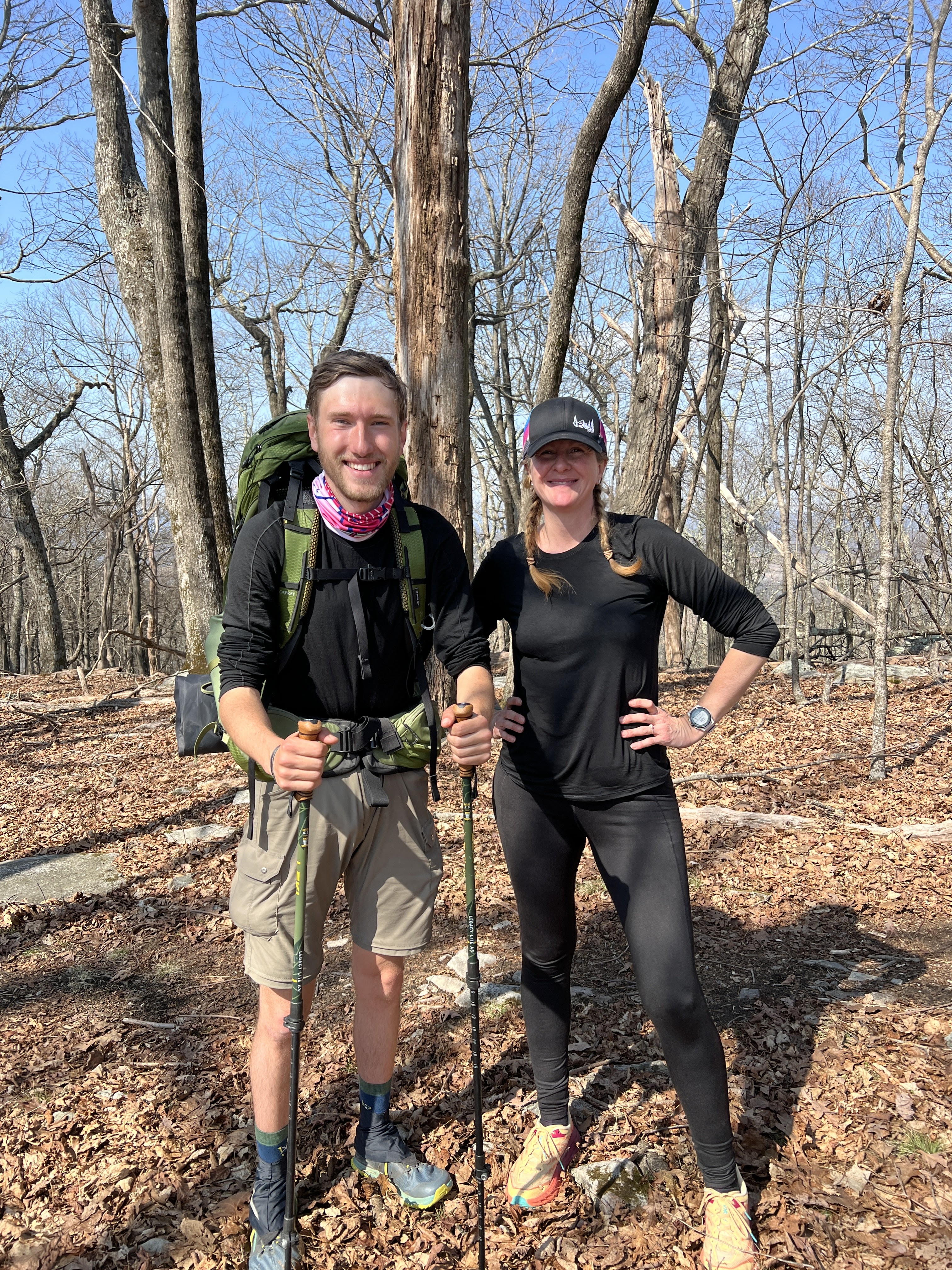
By 9am, we were once again on the trail, this time as a pack of 3. We weren’t quite sure where our day would finish, but we would begin by traversing the ridgeline of the mountain we had slept on.


We were starting the day at an elevation of over 3,000 feet. After climbing the .4 mile up and away from the shelter, the trail was filled with large rocks that had us squeezing through tight spaces, using our arms to pull us up and over, and relying heavily on our trekking poles as we eased down from very large boulders.


Then the trail turned to nearly solid rock with a very sharp drop off to our right. This went on for nearly two miles. My feet were feeling a bit raw from stepping on a slant for so long, but the sky was clear and the view was spectacular.


At the end of this section, we came to the Eastern Continental Divide! This is the halfway point between the Atlantic Ocean and the Gulf of Mexico.

We stopped to take a snack break here in the sunshine, and as we did, along came Pac-Man! He stopped to chat for a few minutes and then we wished him well on his epic journey. He was headed for 27 miles today!
After a sufficient rest, we began again. The trail turned downward, and we enjoyed traveling from the high ground of sparse, dead trees, to the luscious green of the lower elevations. I think Jeff was sick of our shenanigans already!


In no time we arrived at Niday Shelter. We took a blue blaze trail which led to a beautiful little stream to refill our water bottles. There was a tip on the FarOut app that if you took this side trail to the very end, you'd find the best water source. I was happy I made that choice when I found a great little water hole. I took a few minutes to sit there and relax before heading back to the others.


And then Steady was with us! He planned to go at his own pace today, not trying to keep up with Pac-Man. It was fun to see these two thru-hikers in action after meeting them at the hostel a few days prior.

By this point, I had already stripped down to my most basic layers of clothing, and now Misty and Jeff did, too. It was sunny and quite warm and we were loving it!


We decided to push on and find somewhere to camp as we climbed the next mountain. But first, we had more downhill in front of us. Down, down we went, until we were at 1500 feet, and staring at Craig Creek. We had already known that the bridge was out, so we followed a tip that there might be a log to get us across the river. After a bit of searching, we found the log, and with a little difficulty, Misty and I crossed on it.


The tree wasn't difficult to traverse once you were up on top of it, but the getting on and getting off parts were kind of tricky. Jeff opted for another route, crossing at a shallow point of the river, and ended up submerging his feet up to his ankles!

Now that we were across the river, we had some climbing to do! Our destination was the Brush Mountain East Wilderness, 3 miles and 2400 feet up. At first, the switchbacks were tolerable, but as we hiked higher, the trail became a lot steeper. We were stopping often to take small rests, and I just kept thinking how unbelievably difficult the trail had continued to be. There was no conversation between us either, as we were all kind of in our own pits of misery.

And then the sky started to darken. Soon it was sprinkling lightly. Honestly, we didn’t even mind, as the heat and the climb were our main concerns. Onward and upward we went. The sprinkles came and went and then a steadier rain settled in. It wasn’t too bad until we came around a ridge and it seemed like the temperature dropped 15 degrees, the wind was whipping, and the sky opened up. We had about a mile to go, and we were getting nervous about the impending nightfall, but we stopped and pulled out rain gear, hats and gloves. Brr!


Now properly protected, we started again, very anxious to get to our destination. This last mile was a true test of our grit. Straight uphill climbs, plus rain, plus nearly 11 miles already on our feet had depleted us. I noticed a stone leaning up against a tree and made the remark that that was my headstone because I was quite sure I was nearing my death in that moment. RIP AMIE.

Then we saw a bench! THE bench! The app said when we came to the first bench we saw, the AT would go left, but we should turn right to find our campsite. We had made it. I'd love to show you a photo of this blessed bench, but at this point it was raining pretty heavily and my phone was tucked away. After just a couple hundred yards, we finally arrived. We made quick work of setting our tents up in the drenching rain, and I dove inside mine. After getting my sleep area set up, I took a very long time changing out of all of my wet clothes and into warm, dry ones. Everything was so wet, I had to make a "dry end" and a "wet end" in my tent. I think I was a little shell-shocked from the last few miles because then I just laid there on my bed while Misty and Jeff made their dinners. I was definitely having a moment. After a little rest, the rain let up. I decided getting out of my tent was beyond my ability, so I cooked my food right outside the tent door. I whipped together some mashed potatoes and had some jerky with it-a meal fit for a king. The warm food was just what I needed.

After another break in the rain, I scurried out of my tent to stash my bear canister and then quickly crawled back into my warm sack for the night. It had been quite a day.


The rain is getting old. Trying to keep gear dry is alway tough on the trail. Buck Up.
ReplyDelete